
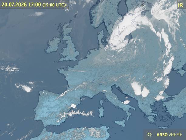
Stationary weather front in causing unstable weather also in N Adriatic region.
Northern Adriatic forecast
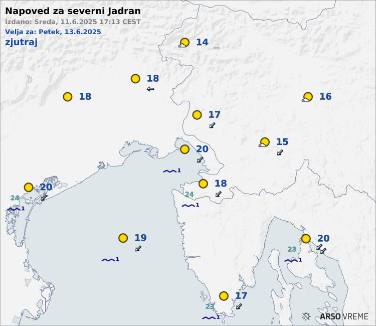
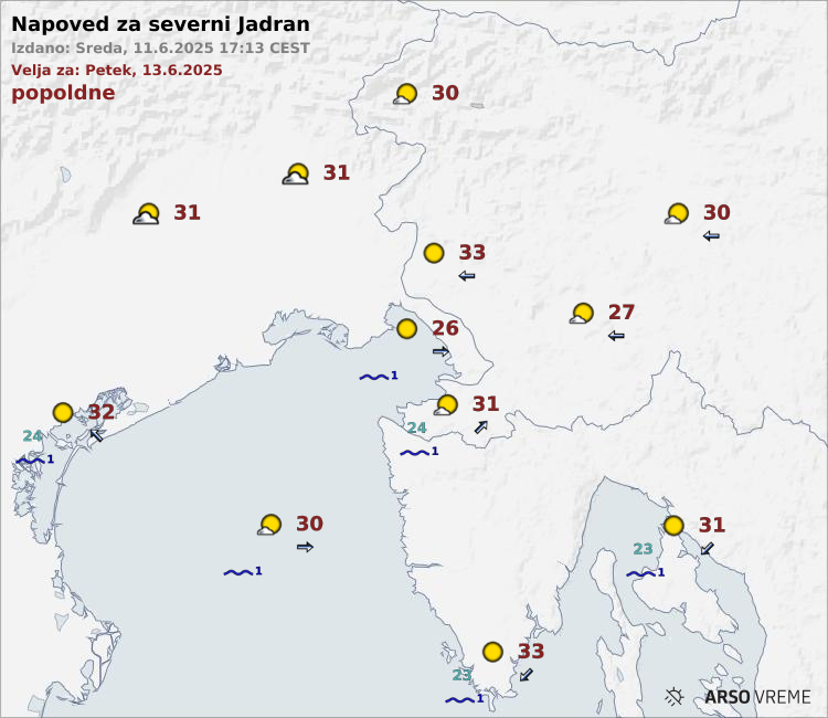
Source: ARSO, last update: Today at 15:15
Forecast for the Croatian coast
Weather report issued by The Marine Meteorological Center Department Split on 20.07.2026 at 12
Warning
In the North Adriatic occasional gusts of NE wind 35-40 knots. A risk of isolated thunderstorms, particularly in the North and in a part of the Central Adriatic.
Synopsis
A trough with a frontal system is approaching the Adriatic from the north.
Weather forecast for the Adriatic for the first 12 hours
At the foot of Velebit NE wind 8-18, this evening up to 24 knots. Elsewhere NW and SW winds 4-14, at night along the coast NE wind 4-14, in the North Adriatic up to 18 knots. The sea 1-2, locally in the open and in the Velebit Channel 3. Visibility about 20 km. In the North and in a part of the Central Adriatic variably cloudy whereas elsewhere partly or mostly clear skies. With an intense increase of cloudiness there is a risk of rain or rain showers with thunder, particularly initially in the North and in a part of the Central Adriatic.
Weather forecast for the next 12 hours
Light to moderate, locally in the North Adriatic also fresh NE wind, at the foot of Velebit also strong. In the open sea light to moderate NW wind. The sea calm or smooth, in the open and in the Velebit Channel also slight. In the North and in a part of the Central Adriatic variably cloudy whereas elsewhere partly or mostly clear skies. With an intense increase of cloudiness there is a risk of rain or rain showers with thunder, particularly in the North and in a part of the Central Adriatic.
Source: DHMZ, last update: Today at 16:16